National Collection Of Aerial Photography

We are the custodians of a unique collection of aerial photography, featuring historic events and places from around the world.

Discover Images From the NCAP Collection

Use our online map browser to find, view and buy already digitised historic aerial images.
A blue-tinted aerial photo. The left-hand side is obscured but might be the sea and a shore. To the right are several buildings, with a road running vertically up the right-hand side.

30 MILLION IMAGES

  • 1,500+

    Images digitised daily

  • 174

    Countries and territories

  • 100

    Years of aerial imagery

NCAP image collections can be helpful in a whole manner of use cases whether personal or commercial.

  • Explosive ordnance disposal

  • Boundary disputes

  • Police investigations

  • Historical research

  • TV and media

  • Land use change & environmental

Every Image Tells a Story

The archives at the National Collection of Aerial Photography in Edinburgh, Scotland contain 30 million aerial photographs of worldwide historic events and places.
A black and white aerial photo of a river delta. A complex pattern of watercourses wind their way through wetlands. The 2 main channels runs vertically through the right side of the image. Data about the image is written along the bottom edge.
Niger Delta, Nigeria
Collection: DOS, Sortie: CAS/6366, Frame: 0158 (1963)

NCAP Image History

A robotic machine arm holds an aerial photographic print. The robotic arm is red and black. In the background is a room filled with screens, machinery, and green lights. To the left someone with their back to us works with a screen.

2021

Robotic digitisation begins

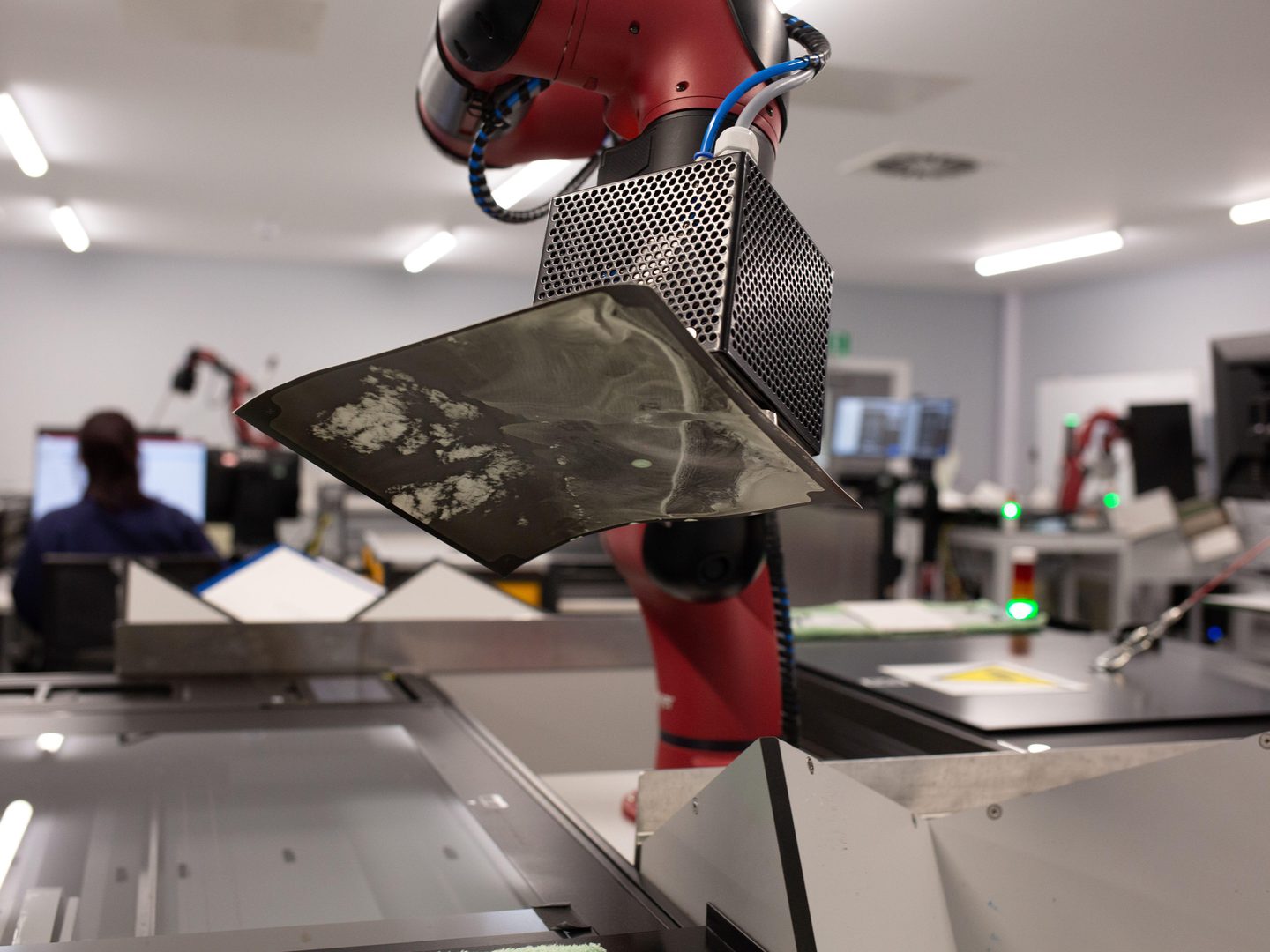
NCAP begins automated print digitisation of the DOS collection. Within just two years, this sees over 1.7 million images preserved and digitised to support international climate change research.

An industrial building with signage that shows the logo of Historic Environment Scotland. Above it is a grey ‘3’ indicating the building unit number. The building is dark blue and has large glass windows. In the far right two white vans are parked.

2008

NCAP moves to Scotland

RCAHMS, which would later merge with Historic Scotland, acquires the aerial photographic collections held at Keele University to form NCAP, the National Collection of Aerial Photography.

Six flat, tan coloured cardboard boxes are piled together. Each box has a label with printed and handwritten text on it. This text gives information, including locations dates and film and print numbers. The labels are slightly discoloured.

1994

End of the Directorate of Overseas Surveys

Multi-decade mapping project of 55 British overseas territories eventually merges with Ordnance Survey.